The Draa Valley is one of southern Morocco's most rewarding overland journeys, a ribbon of green threading through stark desert mountains southeast of Ouarzazate. Watered by the Oued Draa, Morocco's longest river, it earned its nickname, the Valley of a Thousand Kasbahs, from the hundreds of rammed-earth fortresses and fortified villages strung along its banks.
From Ouarzazate the road climbs the Tizi n'Tinififft pass before dropping into the palmeraie at Agdz, then runs through ksour, oases and farmland toward Zagora and the end of the paved road at M'Hamid. For travellers heading to the Sahara, the valley is both a scenic approach and a destination in its own right, layering oasis agriculture, Berber history and trans-Saharan trade into a single unforgettable drive.
Key facts
- Location
- Southeast of Ouarzazate, running through Agdz and Zagora to M'Hamid in the Drâa-Tafilalet region.
- River
- The Oued Draa, widely regarded as Morocco's longest river, rising in the High Atlas.
- Nickname
- The Valley of a Thousand Kasbahs, for its many earthen ksour and fortresses.
- Key stops
- Agdz and Tamnougalt kasbah, then Zagora and M'Hamid at the edge of the desert.
- Landscape
- Continuous date palm groves and oasis farmland framed by arid desert mountains.
- Best paired with
- A Sahara overnight at Erg Chigaga, reached by 4x4 or camel from M'Hamid.
The Oued Draa and the Valley of a Thousand Kasbahs
The Oued Draa rises in the High Atlas, gathers strength where the Dadès and Imini rivers meet near Ouarzazate, and runs roughly 200 kilometres southeast before its waters fade into the sands toward M'Hamid. It is widely regarded as Morocco's longest river, and the oasis it feeds is among the largest palm groves on the continent.
The valley's celebrated name comes from the dense concentration of kasbahs and ksour, fortified earthen settlements built from pisé (rammed earth). Many guard the entrances to palm groves or sit on bluffs above the river. Weathered and reddish-brown, they blend so completely into the landscape that fresh ones reveal themselves at almost every bend, giving the drive its constant sense of discovery.
Agdz and the Kasbah of Tamnougalt
Ouarzazate is the usual starting point. Around 65 kilometres south, after the Tizi n'Tinififft pass, the road reaches Agdz, the valley's first real town, set beneath the distinctive twin-humped silhouette of Jbel Kissane. Agdz, whose name is often translated as resting place, was a stop on the old caravan route and makes a natural pause for the palm groves and a first taste of valley hospitality.
A few kilometres on lies Tamnougalt, one of the oldest and best-preserved ksour in the Draa. Historically the seat of the Berber Mezguita, its 16th-century mudbrick village rises above the palms and can be explored with local guides who explain its defensive design and daily life. Many travellers rate it the architectural highlight of the whole valley.
Palm groves and oasis agriculture
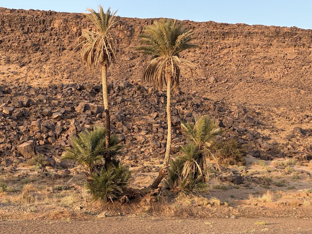
The lifeblood of the Draa is its palmeraie, a near-continuous corridor of date palms that follows the river for tens of kilometres. Beneath the canopy, generations of farmers have worked a layered oasis system: tall palms shade fruit trees, which in turn shelter wheat, barley, alfalfa and vegetable plots, all irrigated by channels drawn from the river and from wells.
Dates are the signature crop and the autumn harvest is a defining moment of the local year. The same palms that supply fruit also provide wood, fronds and shade, underpinning a way of life that has endured here for centuries. To understand the trees and species that make these oases possible, see our guide to desert trees of southern Morocco.
Trans-Saharan trade and Berber heritage
For centuries the Draa was a great trans-Saharan trade artery. Caravans moved salt, gold, spices, manuscripts and enslaved people northward from Timbuktu and the Sahel toward Sijilmassa, Fes and the Mediterranean, with the valley's ksour serving as waypoints, markets and strongholds along the way.
That long history of exchange shaped a layered population of Amazigh (Berber), Arab and Saharan communities, reflected today in local crafts, music and architecture. At the southern edge of Zagora, the famous painted sign reading Tombouctou 52 jours recalls the historic caravan journey time to Timbuktu and remains the valley's most photographed reminder of this trading past. Our overview of Berber culture explores these traditions in more depth.
Zagora, M'Hamid and the road to the desert
Zagora is the valley's largest town and main service hub, with markets, accommodation and tour operators, and it functions as a gateway for trips into the dunes. Beyond it the palmeraie continues to M'Hamid, the last village on the paved road, where the cultivated valley finally gives way to open desert.
From M'Hamid, travellers strike out by 4x4 or camel toward the dunes of Erg Chigaga, the largest dune field accessed from this side of the Sahara. The Draa thus offers a complete southern arc, from green oasis to sand sea, and pairs naturally with desert camping for those who want to spend a night beneath the stars.
Driving the Draa and fitting it into your itinerary
The Ouarzazate to Zagora drive is roughly 165 kilometres on a paved road and is comfortably done in a half-day, though most travellers take longer to stop at viewpoints, ksour and palm groves. M'Hamid lies about 95 kilometres further south. The scenery is the attraction, so an unhurried pace rewards you most.
The valley slots neatly into a southern circuit. Many visitors arrive over the High Atlas via Ouarzazate and Ait Benhaddou, then descend the Draa to Zagora or M'Hamid for a Sahara overnight. It can be combined with the gorges to the northeast, the Dades and Todra, on a longer loop, or treated as a focused two- to three-day desert escape.